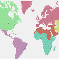
Build master plans of cities, combine information from census, satellite/drone imagery, publicly and privately available information to make informed decisions about city expansion, where to place your business and many more.
Predominantly, our planning projects revolve around SDG 11, which is “Make cities inclusive, safe, resilient and sustainable”.
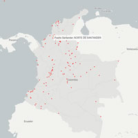
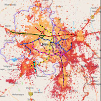
- Assisting various agencies (UN-Habitat, Government of Colombia, CAF and 100RC) for monitoring the quantitative and qualitative aspects of cities’ urban expansion. Avg. plot size, block size, street width, walkability, intersection density, share of urban layouts are the few metrics that can be studied in detail.
- Finding solutions for urban issues through quantifying the share of land for various uses.
- Helping in assessing quality and access to public and private open spaces in cities.
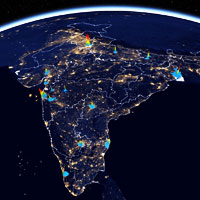
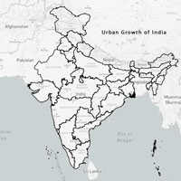
- Temporal studies urban growth.
- Studies of compactness of cities by measuring urban morphology (building heights, urban forms etc)
- Preparing nodal plans for planning agencies as well as accessing impact of urban growth using satellite imagery or drones.
- Assessing developmental milestones for cities
NUMBERS THAT MATTER
0
+
CITIES URBAN LAYOUT STUDIED
0
hectares
HECTARES URBAN LAYOUT PATTERNS ANALYZED
0
km
ARTERIAL ROAD MAPPED
0
NUMBER OF BUILDING FOOTPRINTS EXTRACTED