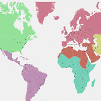
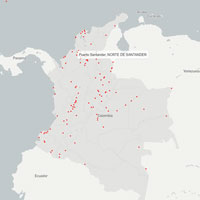
UAV Service
When satellite imagery is insufficient for our client needs, we have a team of flight engineers and pilots that can go into the field and extract all the required features using our drones. We can get high resolution imagery as well as create high resolution 3D topography of any location accessible via UAVs equipped with high resolution cameras as well as Lidar. We can extract information about building heights, road networks, utility lines using this information. Our proven drone solutions simplify the collection and analysis of geospatial data, allowing professionals in urban planning, agriculture and humanitarian aid to make better decisions, faster.
Using a drone can vastly reduce the time spent collecting accurate data. By acquiring raster data from the sky – in the form of geo-referenced digital aerial images, with resolutions as sharp as 1.5 cm (0.6 in) per pixel – you can gather millions of data points in one short flight.
With collection made so simple, our clients can focus your energy on using and analysing data, rather than working out how to gather it.